

Est. 17th Century
A Land With a Name
The story of Morgan's Pass begins with one of history's most legendary figures — and continues to this day.
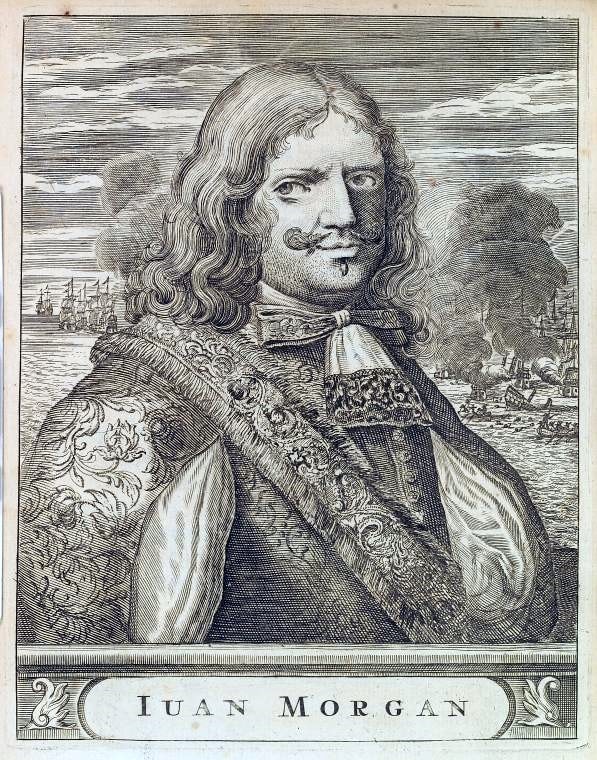
Sir Henry Morgan, c. 1635–1688
Key Dates
The Man Behind the Name
Sir Henry Morgan
Privateer. Buccaneer. Lieutenant Governor of Jamaica.
Sir Henry Morgan (c. 1635–1688) was one of the most successful and feared privateers of the 17th century. Born in Wales, he rose to become the most powerful man in the Caribbean — commanding fleets, sacking Spanish cities, and ultimately being knighted by King Charles II of England.
Morgan's exploits were legendary: the raid on Portobelo in 1668, the sacking of Maracaibo in 1669, and his audacious crossing of the Darién to capture Panama City in 1671. These were not acts of piracy — Morgan operated under letters of marque, making him a privateer acting on behalf of the English Crown.
After his privateering days, Morgan was appointed Lieutenant Governor of Jamaica — a position he held with authority and cunning. He was granted substantial land holdings across the island, and the valley and pass that now bear his name in Clarendon are a direct legacy of his presence on Jamaican soil.
He was knighted by King Charles II — the same man who had once ordered his arrest.
The Land Itself
Morgan's Valley, Clarendon
The land known as Morgan's Pass sits in Morgan's Valley — a quiet, fertile corner of Clarendon Parish. The name is not coincidental. These lands were historically associated with Sir Henry Morgan's Jamaican holdings, and the valley has carried his name for over three centuries.
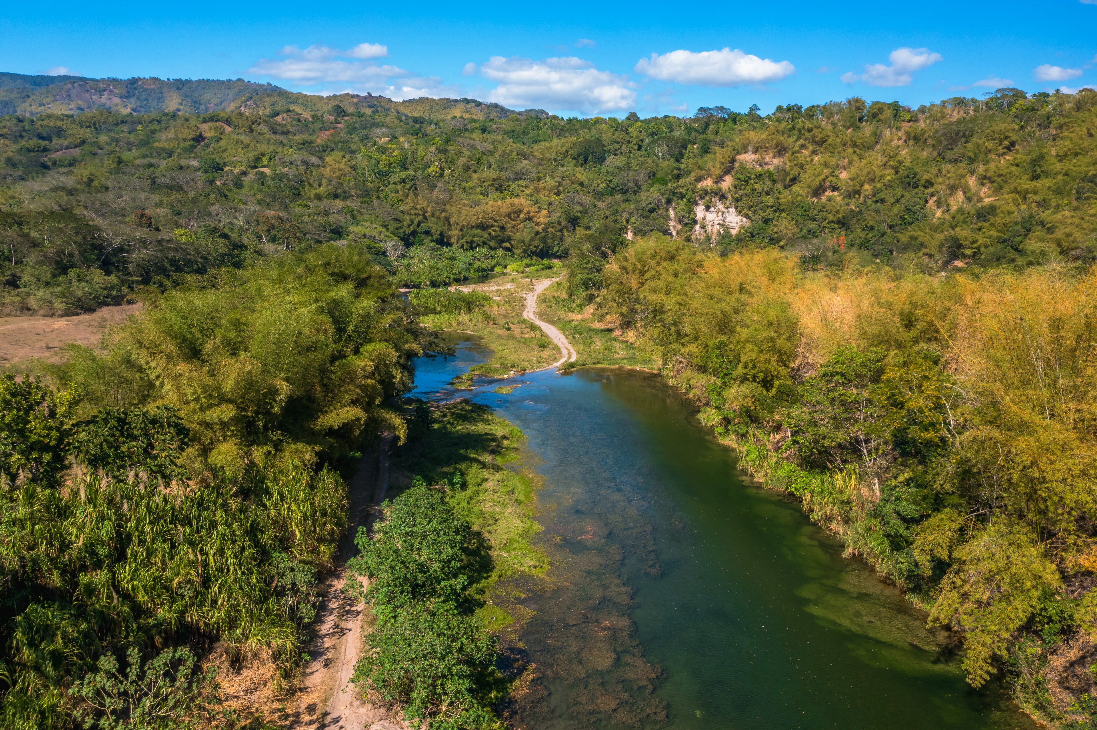
Clarendon is one of Jamaica's most productive parishes — known for its agricultural output, its mineral deposits, and the Rio Minho, one of the island's most reliable rivers. Morgan's Pass sits at the intersection of all three: fertile soil, extractable stone, and permanent water.
The property spans 70 acres across four lots, with the Rio Minho forming a natural boundary. It has been used for agriculture, grazing, and small-scale quarrying over the centuries — and today carries Parish Council approval for six distinct uses, from mining to hotel development.
The Plantation Era
Centuries of Cultivation
Like much of Clarendon, the land at Morgan's Pass passed through the plantation era — a period that shaped Jamaica's landscape, economy, and culture in ways that are still visible today. The fertile valley soils that made it valuable for sugar and provision crops are the same soils that make it valuable for agriculture now.
The Rio Minho — which borders the property — was a critical resource during this period, providing water for cultivation and a natural transport corridor. Its reliability, even in drought, is a feature that has defined the land's value across every era of its history.
Orange Groves, Tobacco & the Iron Road
A Working Land Through the Centuries
Long before the current era of quarrying and mixed agriculture, Morgan's Pass was an orange farm. The valley's fertile soils and permanent river water made it ideally suited to citrus cultivation — a crop that sustained the estate through the 19th and early 20th centuries and gave the neighbouring Orange River its name.
Tobacco was also grown on the property. Clarendon was one of Jamaica's earliest tobacco-producing parishes, and the land at Morgan's Pass formed part of that agricultural tradition — a crop that connected the valley to Jamaica's colonial export economy long before sugar came to dominate the island.
The Jamaica Railway Corporation line runs directly through the property — one of the most significant infrastructure assets on any land in Clarendon. The railway was used to transport agricultural produce across the island, connecting interior farming communities to the coast. That line still runs through Morgan's Pass today, giving any future operator direct rail access for freight, bulk materials, and heritage tourism that no road-only site in the region can match.
Orange Farm
Citrus cultivation sustained the estate through the 19th and early 20th centuries — the neighbouring Orange River takes its name from this legacy.
Tobacco Cultivation
One of Clarendon's earliest tobacco-producing estates, connecting Morgan's Pass to Jamaica's colonial export economy.
Jamaica Railway Line
The original Jamaica Railway Corporation line runs directly through the property — direct rail access for freight, logistics, and heritage tourism.
A Living Heritage Asset
The Tourism Opportunity
Few properties in Jamaica can claim a direct connection to Sir Henry Morgan. That connection is not merely historical trivia — it is a genuine tourism asset. The Caribbean heritage tourism market is growing, and properties with authentic, documented historical significance command premium attention from developers, operators, and visitors alike.
Authentic provenance
The Morgan name is documented in the valley and pass — not a marketing invention.
Caribbean heritage tourism is growing
Visitors increasingly seek authentic historical experiences beyond the beach resort.
Parish Council approval includes tourism
The approved change of use explicitly covers heritage tourism development.
Unique positioning
No other property in Jamaica offers this combination of Morgan heritage, river frontage, and multi-use zoning.
National Library of Jamaica Archives
Primary Sources & Historical Documents
These documents — held in the National Library of Jamaica and Clarendon parish records — establish the unbroken chain of title from Sir Henry Morgan's original 836-acre patent through successive owners to the present day. They are among the rarest provenance records available for any property in Jamaica.
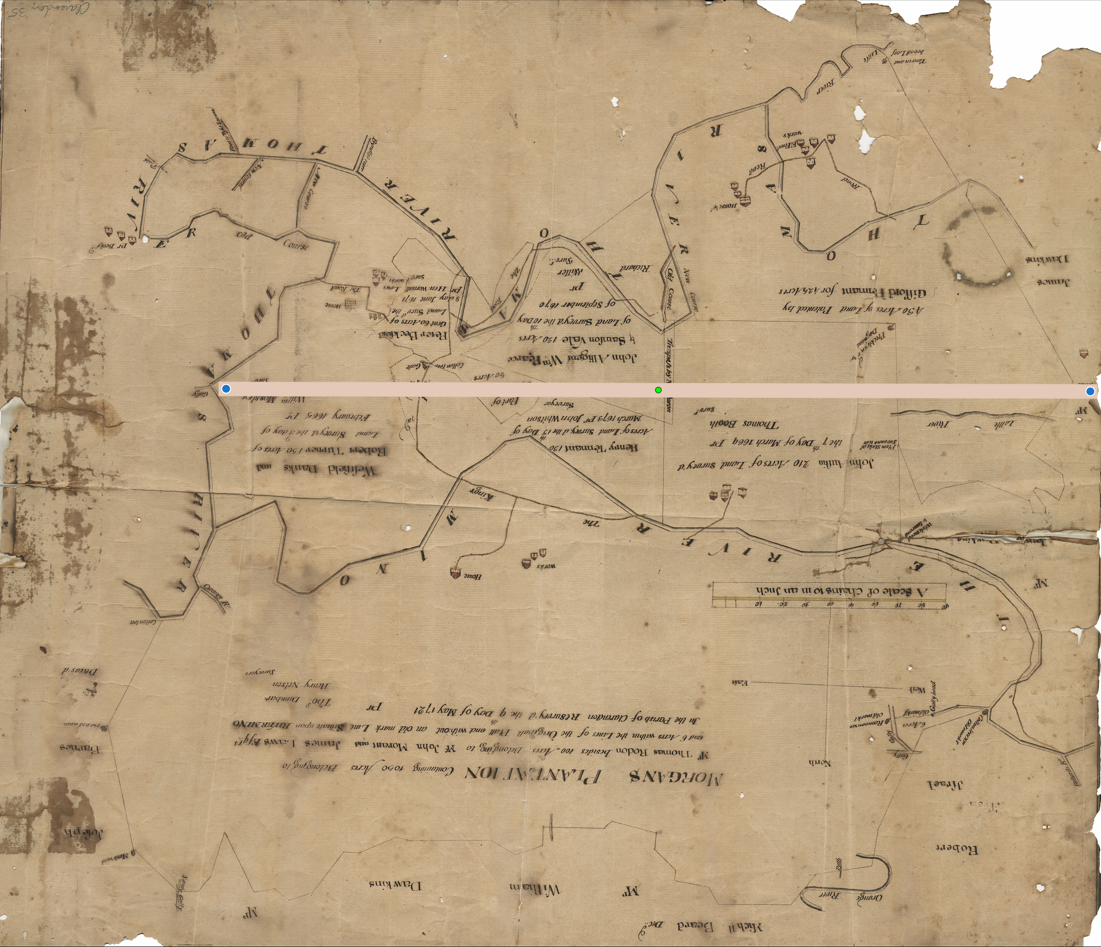
Resurveyed May 9, 1721
Morgan's Plantation — Survey Map
The plantation survey map of Morgan's Plantation in the Parish of Clarendon, showing the Thomas River course, neighbouring estates (Dawkins, Williams, Hobert, Israel), and the scale of chains. The bottom inscription confirms: "In the Parish of Clarendon, Resurvey'd the 9 Day of May 1721 — Containing 900 Acres belonging to Mr Thomas Rodon, besides 100 Acres belonging to W. John Morant and James Lewis Esqr. — Tho. Dunbar, Surveyor, Henry Nelson."
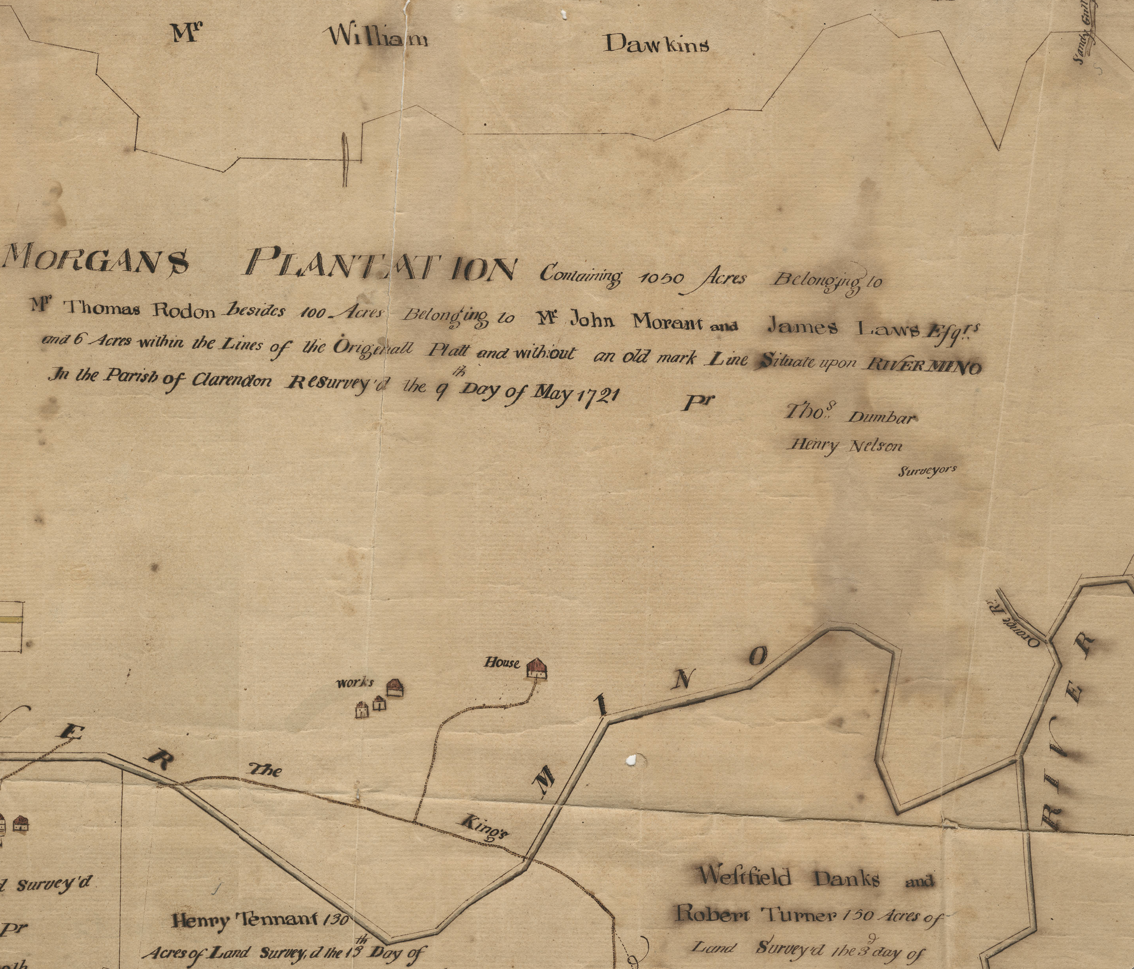
Resurveyed May 9, 1721
Morgan's Plantation — Detail View
A high-resolution detail view of the Morgan's Plantation survey, clearly showing the inscription "MORGANS PLANTATION Containing 1050 Acres Belonging to Mr Thomas Rodon besides 100 Acres Belonging to Mr John Morant and James Laws Esqrs and 6 Acres within the Lines of the Originall Platt and without an old mark Line Situate upon RIVERMINO In the Parish of Clarendon Resurvey'd the 9 Day of May 1721." Surveyors: Thos. Dumbar and Henry Nelson.
Surveyed July 23, 1670 · Conveyances to 1721
Sir Henry Morgan — Chain of Title
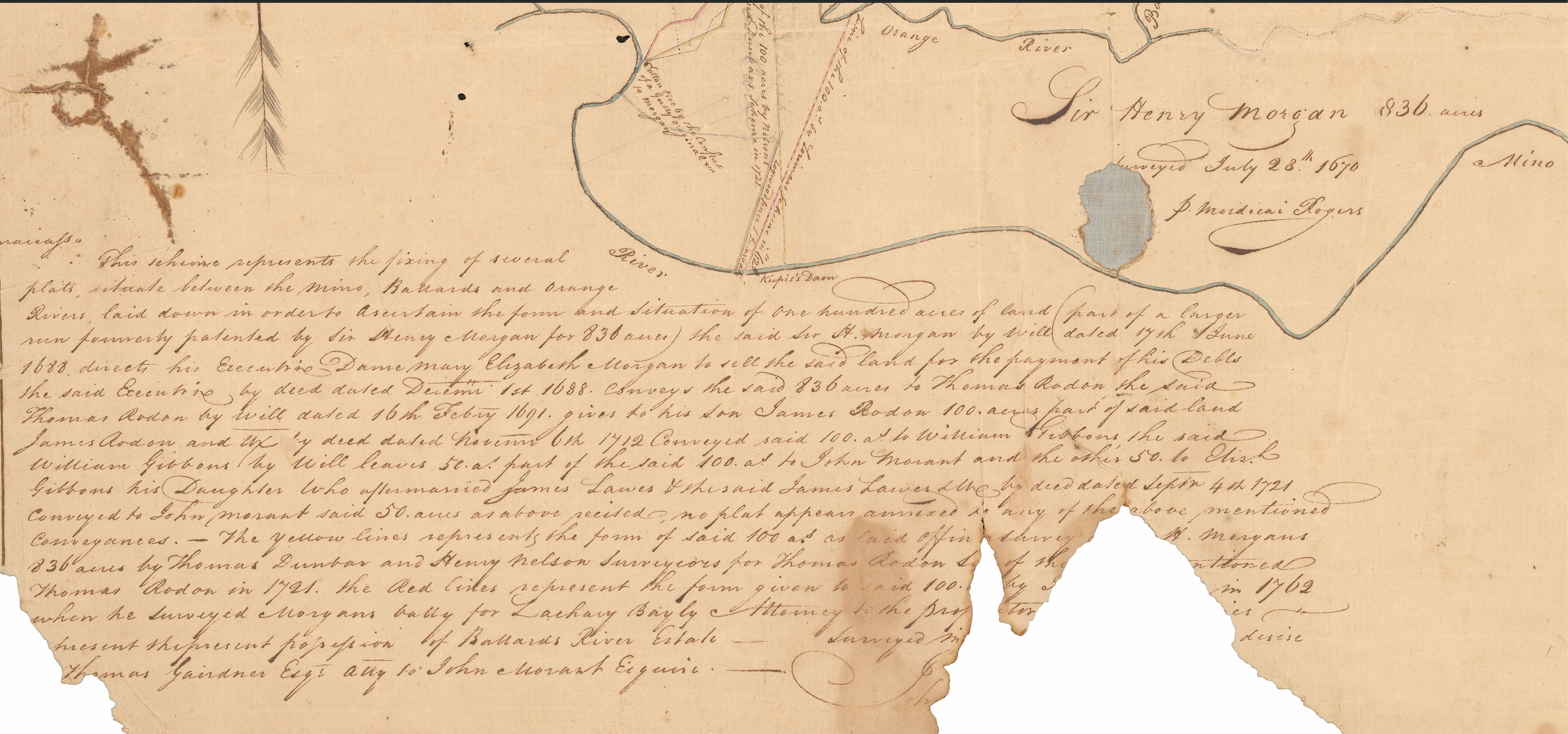
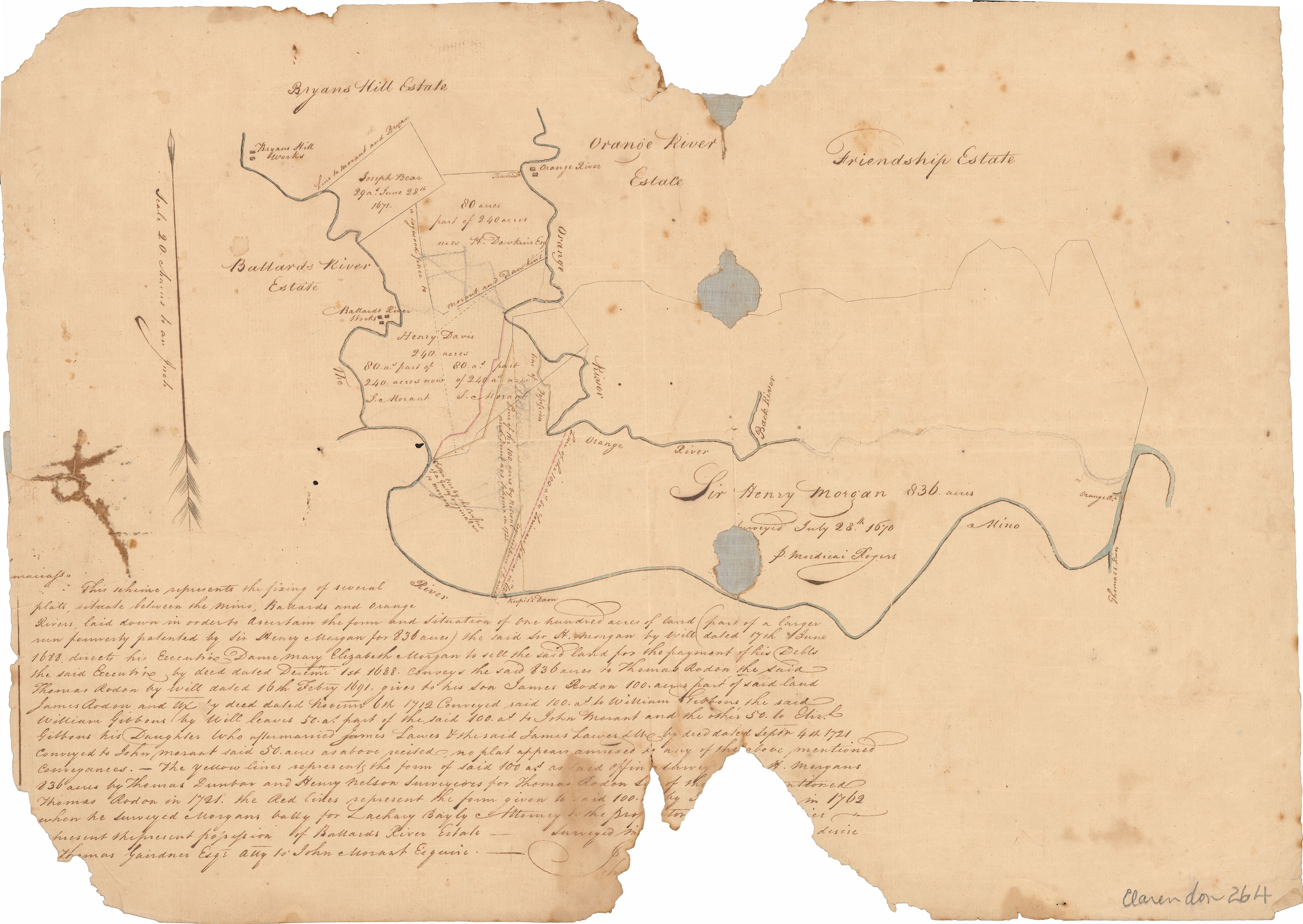
The definitive provenance document from the National Library of Jamaica. Inscribed "Sir Henry Morgan 836 acres, Surveyed July 23rd 1670 by Mordecai Rogers", it narrates the full chain of title: Morgan's 1688 will directing Dame Mary Elizabeth Morgan to sell the land to pay his debts; conveyance to Thomas Rodon December 1, 1688; bequest to son James Rodon 1691; conveyance to William Gibbons 1712; bequest of 50 acres each to John Morant and Eliz. Gibbons (who married James Lawes); and final conveyance to John Morant by deed dated September 4, 1721.
Surveyed July 28, 1670
Sir Henry Morgan — 836 Acres Close-Up
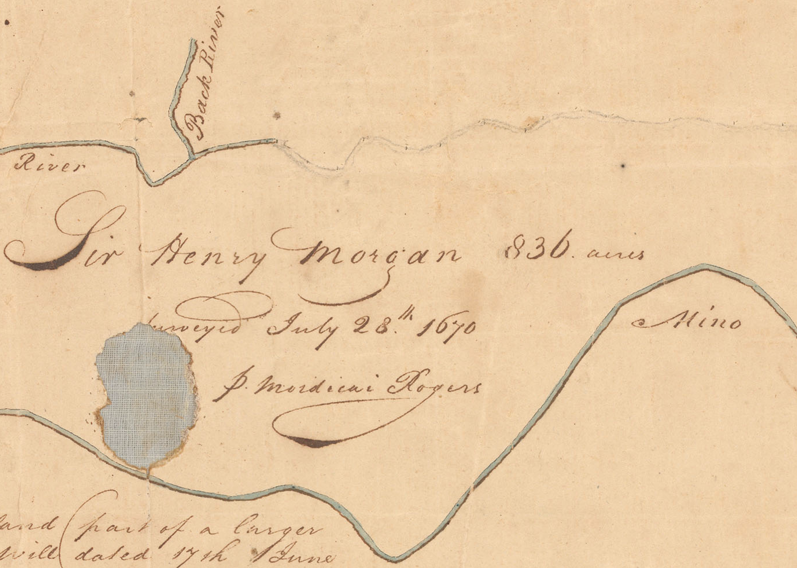
A close-up detail of the original survey plat showing the handwritten inscription "Sir Henry Morgan 836 acres, Surveyed July 28th 1670, p. Mordecai Rogers" — the founding document of the Morgan's Pass estate. The Rio Minho ("a Mino") is clearly marked as the eastern boundary.
Surveyed July 23, 1670
Sir Henry Morgan — 836 Acres
The original survey plat showing Sir Henry Morgan's 836-acre patent in Clarendon, with neighbouring estates (Bryans Hill, Ballards River, Orange River, Friendship) and handwritten annotations tracing subsequent conveyances from 1671 through 1721.
Surveyed early 1818
Morgan's Valley Estate
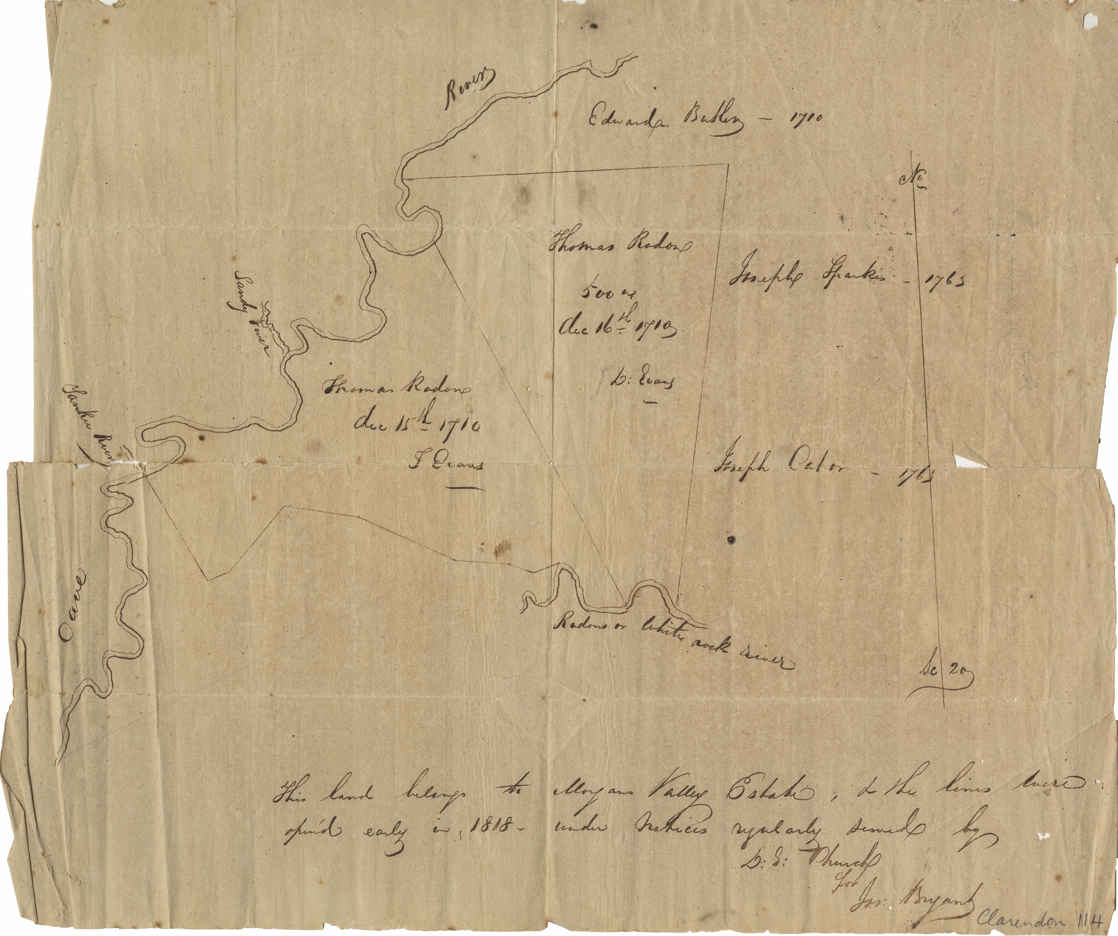
Hand-drawn survey of Morgan's Valley Estate showing the river boundaries (Sandy River, Cave River, Radons or White Rock River) and land parcels. Inscribed: "This land belongs to Morgan Valley Estate, to the lines here specified early in 1818 — under Justices regularly served by D.S. Church, for Jos. Bryant, Clarendon 114."
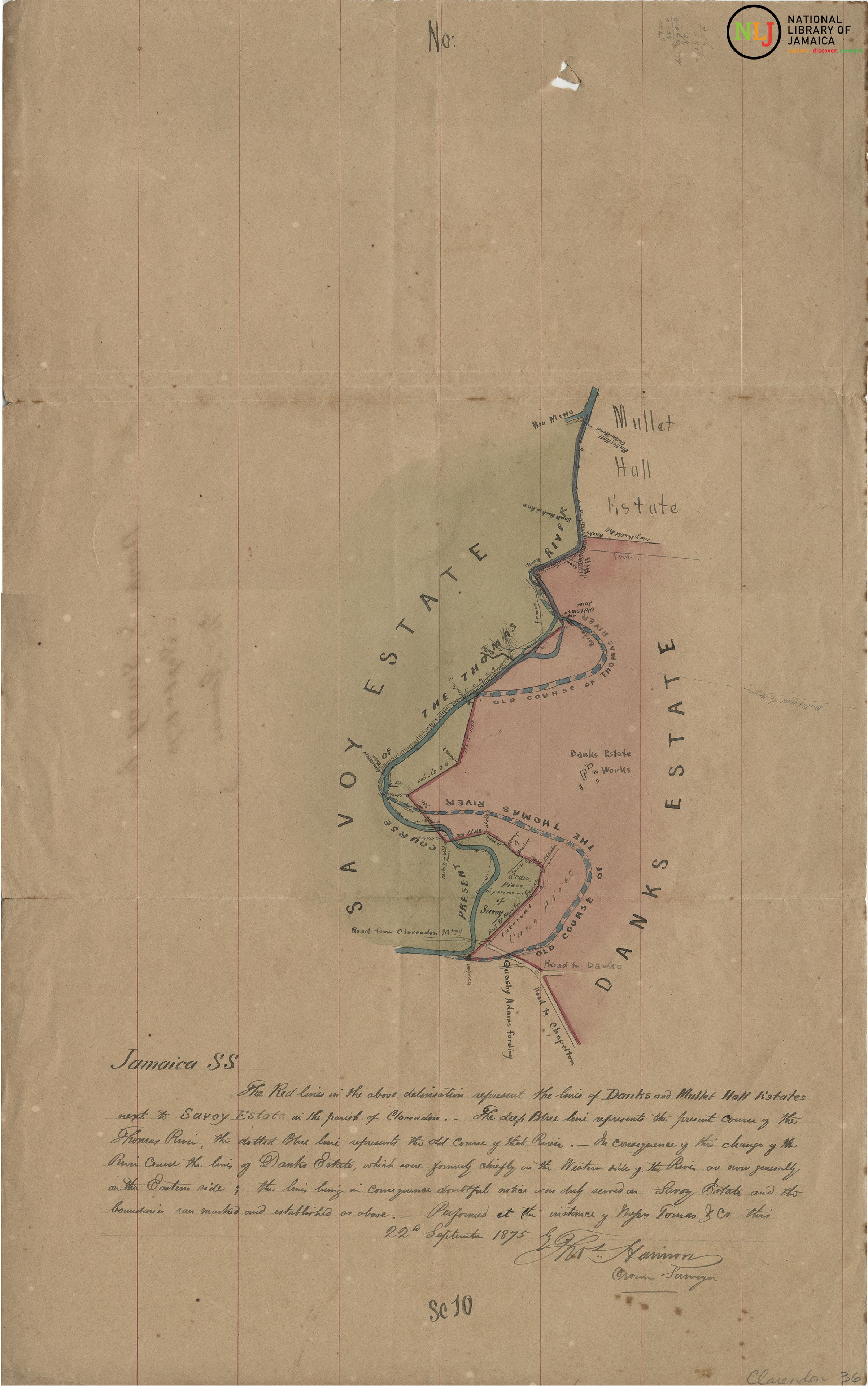
September 22, 1875
Danks & Mullet Hall Estate
Coloured survey map showing the boundaries of Danks Estate and Mullet Hall Estate in the parish of Clarendon, with the Rio Minho (Thomas River) course — both old and present — marked in blue. Performed at the instance of Major Thomas & Co. Signed by the Crown Surveyor.

c. 1875
Danks Estate — Detailed Survey
A second detailed survey of Danks Estate showing the Savoy Estate boundary, the Thomas River course, and the Danks Estate Works. Confirms the Rio Minho as the defining boundary of the land that would become Morgan's Pass.
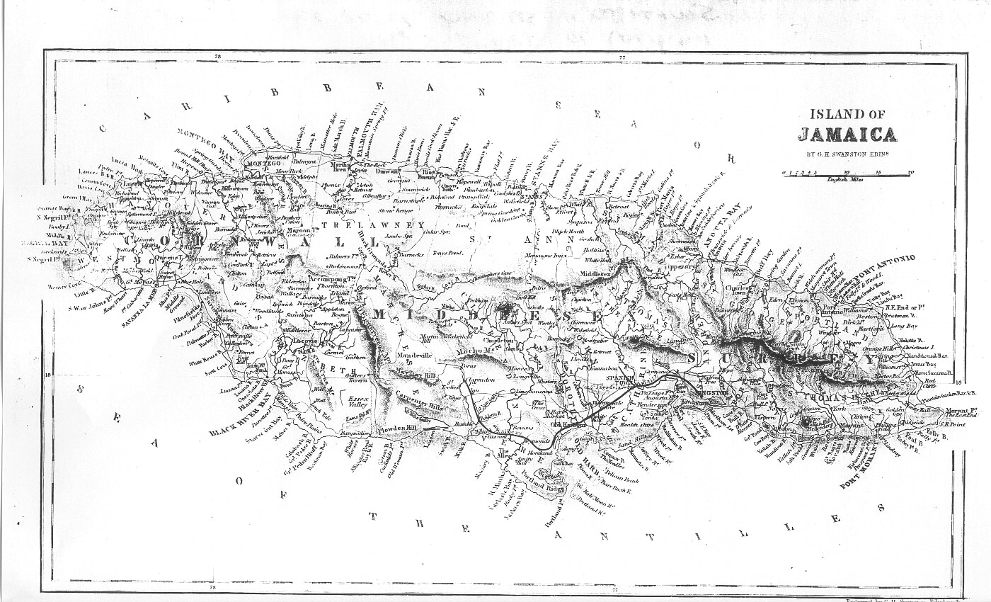
1845
Island of Jamaica
"Island of Jamaica" by G.H. Swanston, Edinburgh — a detailed cartographic survey of the entire island showing parishes, rivers, roads, and settlements. Clarendon parish and Morgan's Valley are identifiable in the central-south region.
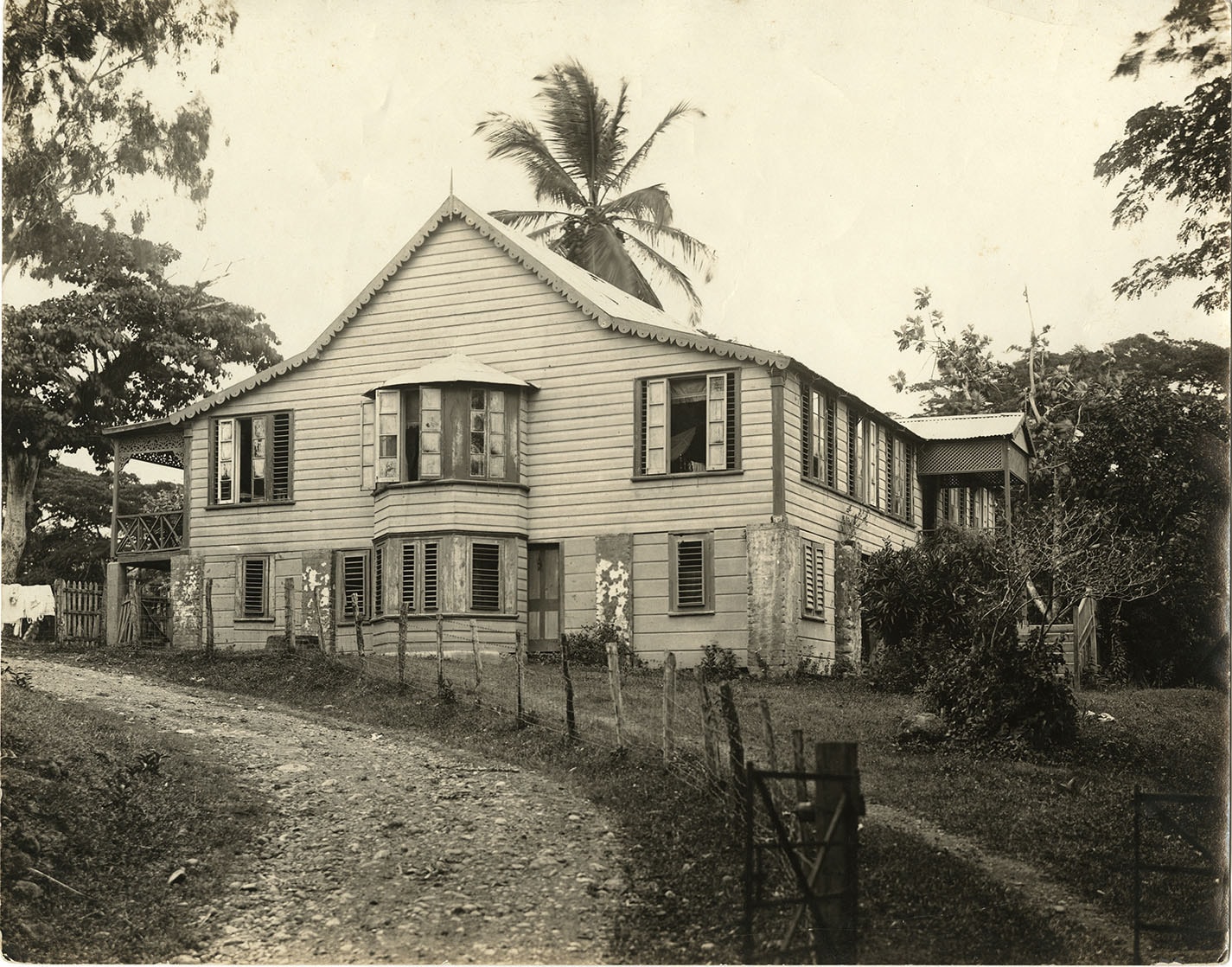
c. late 19th century
Morgan's Valley Great House
A rare photographic record of the Morgan's Valley Great House — the colonial plantation residence that stood on the estate. The two-storey timber structure with decorative gabled trim and shuttered windows is characteristic of Jamaican plantation architecture of the period.
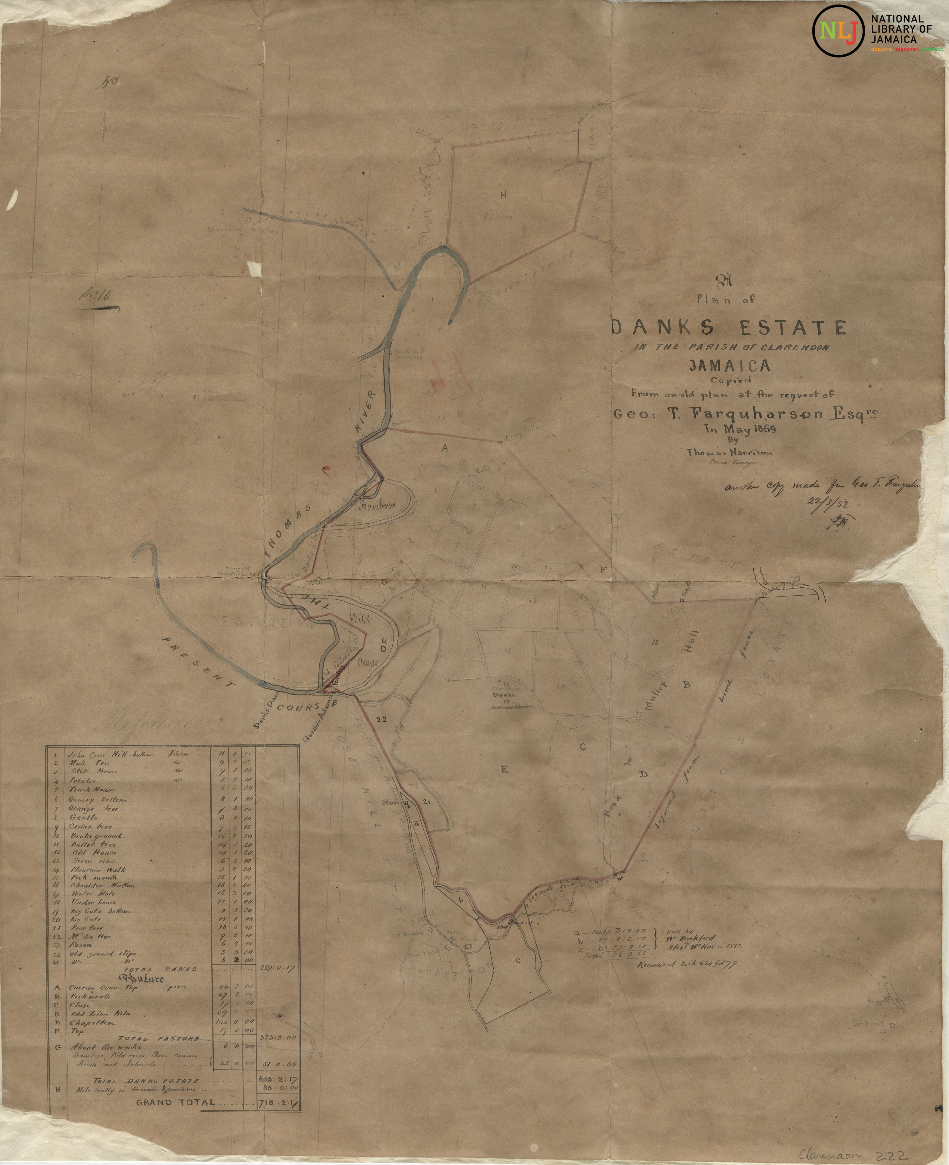
May 1869
Danks Estate — Plan of 1869
A detailed plan of Danks Estate in the Parish of Clarendon, Jamaica — copied from an old plan at the request of Geo. T. Farquharson Esq. by Thomas Harrison, Crown Surveyor, in May 1869. Shows the Thomas River course, estate divisions, pasture, cane pieces, and the Danks Estate Works. The inventory lists total canes of 229 acres and total pasture of 275 acres, with a grand total of 718 acres.
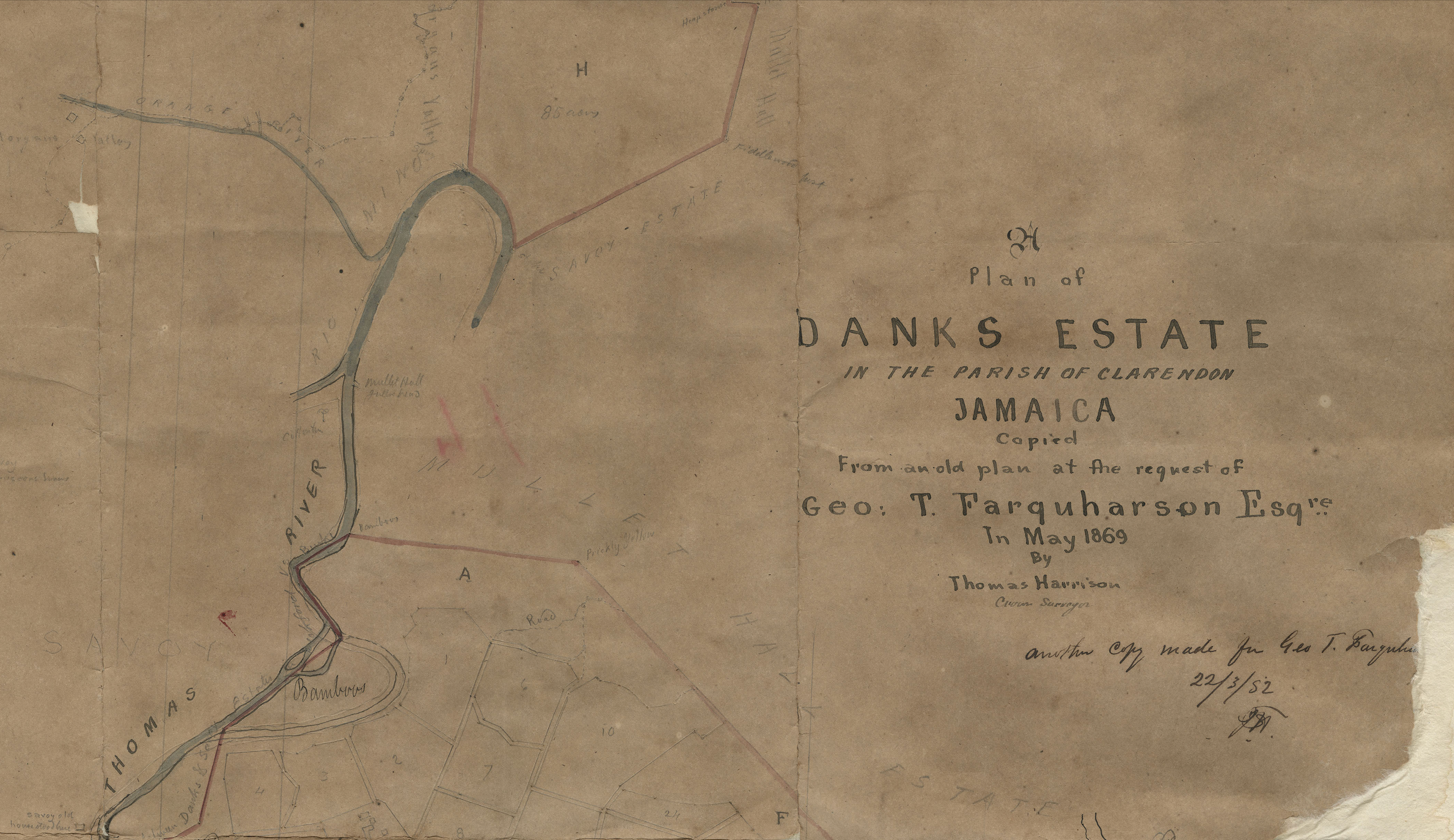
c. 1869–1875
Danks Estate — Second Survey
A second detailed survey of Danks Estate in the Parish of Clarendon showing the Thomas River course, Savoy Estate boundary, Mullet Hall Estate, and the Danks Estate Works. Confirms the Rio Minho as the defining boundary of the land that would become Morgan's Pass, and documents the shifting river course that altered the estate boundaries between Danks and Savoy estates.
Provenance
These documents establish an unbroken chain of title from Sir Henry Morgan's original 1670 patent through the Morgan's Valley Estate, Danks Estate, and successive owners to the present day. Full documentation is available to serious enquirers.
Ready to Be Part of the Next Chapter?
Morgan's Pass has carried this name for over 300 years. The next era of its story is yours to write.